Winter storm warning: A hits the Sierra Nevada in May
A rare winter storm warning has been issued for the Sierra Nevada, Wyoming, due to a powerful late-season storm expected to bring heavy snowfall and severe conditions. This unusual blizzard threatens major highway closures and travel chaos, particularly on Interstate 80 over Donner Pass.
Snowfall totals in the Sierra Nevada are anticipated to reach between 1 to 2 feet at elevations above 6,000 feet, with the highest peaks potentially receiving up to 4 feet of snow. Wind gusts are also expected to be fierce—ranging from 50 to 70 mph and possibly reaching up to 80 mph in exposed areas.
This storm is not isolated; it follows a pattern of unpredictable winter weather that can occur even in May. In fact, a winter storm watch has also been issued for specific mountain regions of Wyoming, where heavy snow is expected, with totals ranging from 4 to 10 inches and up to 16 inches at elevations above 9,000 feet.
Key impacts of the storm:
- Travel advisories have been issued urging residents to postpone non-essential travel until at least Tuesday.
- Interstate 80 over Donner Pass is considered highly vulnerable to closures.
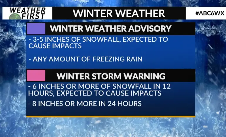
- The National Weather Service defines a winter storm watch as indicating a 50% chance of a hazardous winter weather event occurring.
The National Weather Service stated, “A powerful late-season system has triggered a winter storm warning in the Sierra Nevada, bringing unusually severe conditions for early May.” Emergency supplies are being recommended for those who must travel during this period.
As the storm moves eastward into Nevada, Colorado, and New Mexico after impacting California, officials are preparing for further disruptions. The unpredictability of weather patterns in mountainous regions can lead to rapid changes in conditions—making preparedness essential.